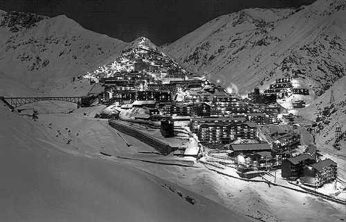
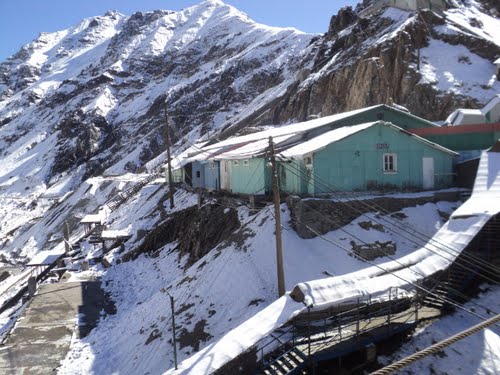
Sewell is an uninhabited Chilean mining town located on the slopes of the Andes in the commune of Machali in Cachapoal Province, Libertador General Bernardo O'Higgins Region, at an altitude of between 2,000 and 2,250 metres.
History
The town was founded in 1906 by the Braden Copper Company to extract copper from the El Teniente mine. It was named after the company's first president, Barton Sewell.
During the Great Depression, the Braden Copper Company became a subsidiary of Kennecott Copper Company. In 1917 the foundry or smelter was moved from Sewell to which soon also developed a town around it.
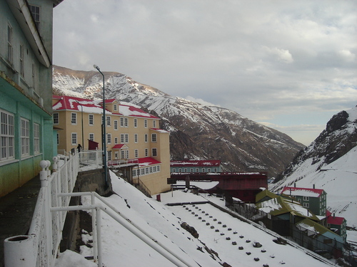
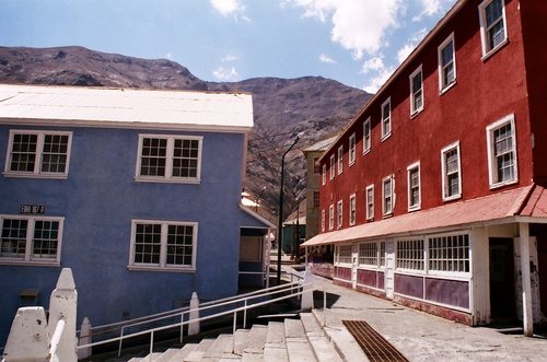
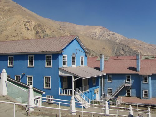
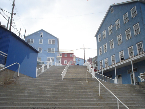
Originally male workers lived in shared housing called colectivos. Later family housing was added. Playgrounds, plazas, shops, and a movie theatre later followed. Pedestrians walked up and down vertical staircases. There were unpaved horizontal streets, and no cars. On the west facing side of Cerro Negro a camp for foreign personnel developed.
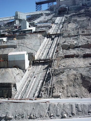
Ore was taken down the mountainside to Graneros where it was loaded onto railway cars. The narrow gauge railway that connected Sewell to the nearby town of Rancagua began in 1906 and was completed in 1911. Total distance covered was 45 miles with an elevation change of 5,000 feet.
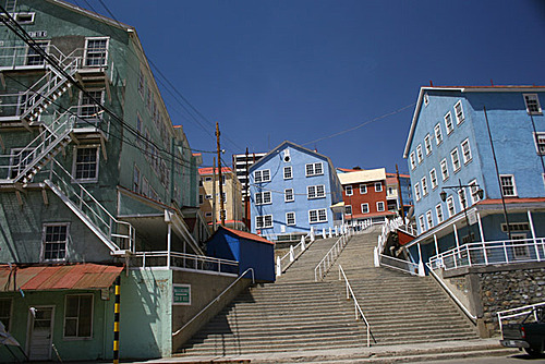
By 1915 Sewell boasted a model hospital, a fire department and a social club. The buildings and homes were made out of timber, and painted bright colors such as yellow, red and blue. At its peak in 1960, more than 16,000 inhabitants called Sewell home. By 1918 the town housed more than 12,000 people.
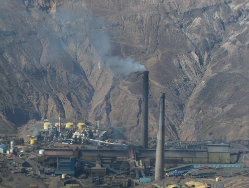
Sewell is known as the "City of Staircases". The town was built on terrain too steep for wheeled vehicles, around a large central staircase rising from the railway station called the Escalara Central. All supplies had to be brought into the city via a narrow gauge railroad. Pueblo Hundido contained the living quarters while below the ore body was El Establecimiento contained the concentrator, hudroelectric plant, and a tramway.
On 8 Aug. 1944, 102 people lost their lives in an avalanche when the slopes above the town failed.
In June 1945 there was a tragic fire which killed 355 workers through smoke inhalation. This led to the development of more safety regulations. Additional, ever-present threats to the city included earthquakes, avalanches and explosions.
Decline
In 1967 the Kennecott Copper Company lost ownership of the site as the Chilean government achieved a 51% stake in the company. At this time, most people were moved to Rancagua and the Copper Highway was built for commuting purposes.
In 1971 the mine was nationalised by the Allende government, and in 1977, after over seven decades of active life, and having supported the construction and exploitation of the largest underground mine in the world, the state-owned CODELCO started moving families out of Sewell into the valley, and the demolition of buildings began.
Preservation
Demolition was finally halted at the end of the 1980s, and in 1998 the Chilean Government declared Sewell a National Monument. UNESCO designated it a World Heritage Site in 2006.
During the 1980s the remaining buildings were remodeled to house contractors. There are 50 restored buildings remaining and a history museum is housed in one of the structures.
CODELCO uses several buildings for offices, but only the basic facilities required for mining remain. It is not possible to access the area with private vehicles and only tour operators in Santiago and Rancagua are allowed to visit the site.
In 1999 Chile’s College of Architects declared Sewell one of Chile’s 10 most important urban works. There have been 9 books written about life at Sewell.