Struve Geodetic Arc, Raipas

The Struve Geodetic Arc is a chain of survey triangulations stretching from Hammerfest in Norway to the Black Sea, through ten countries and over 2,820 km, which yielded the first accurate measurement of a meridian.

The chain was established and used by the German-born Russian scientist Friedrich Georg Wilhelm von Struve in the years 1816 to 1855 to establish the exact size and shape of the earth. At that time, the chain passed merely through two countries: Union of Sweden-Norway and the Russian Empire. The Arc's first point is located in Tartu Observatory in Estonia, where Struve conducted much of his research.

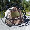
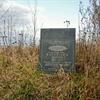
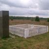
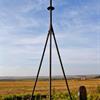
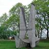
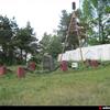
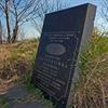
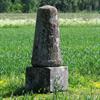
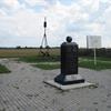
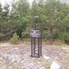
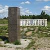
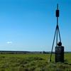
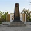
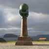
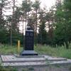
In 2005, the chain was inscribed on the World Heritage List as a memorable ensemble of the chain made up of 34 commemorative plaques or built obelisks out of the original 265 main station points which are marked by drilled holes in rock, iron crosses, cairns, others.

Measurement of the triangulation chain comprises 258 main triangles and 265 geodetic vertices. The northernmost point is located near Hammerfest in Norway and the southernmost point near the Black Sea in Ukraine. This inscription is located in ten countries, the most of any UNESCO World Heritage.

  • Struve Geodetic Arc (LILLE-REIPAS)
  • Stone Whale
  • Looking west from Struve Geodetic Arc marker in Alta

Country:
Norway
Rating:
1
Latitude:
69,9383869
Longitude:
23,3599112
Wikipedia:
Link

  • 1

    Struve Geodetic Arc, Avasaksa (Ylitornio)

    The Struve Geodetic Arc is a chain of survey triangulations stretching from Hammerfest in Norway to the Black Sea, through ten countries and over 2,820 km, which yielded the first accurate measurement of a meridian.

  • 1

    Struve Geodetic Arc, Baelljasvarri

    The Struve Geodetic Arc is a chain of survey triangulations stretching from Hammerfest in Norway to the Black Sea, through ten countries and over 2,820 km, which yielded the first accurate measurement of a meridian.

  • 1

    Struve Geodetic Arc, Baranowka

    The Struve Geodetic Arc is a chain of survey triangulations stretching from Hammerfest in Norway to the Black Sea, through ten countries and over 2,820 km, which yielded the first accurate measurement of a meridian.

  • 1

    Struve Geodetic Arc, Beresnaki (Paliepiukai)

    The Struve Geodetic Arc is a chain of survey triangulations stretching from Hammerfest in Norway to the Black Sea, through ten countries and over 2,820 km, which yielded the first accurate measurement of a meridian.

  • 1

    Struve Geodetic Arc, Felshtyn

    The Struve Geodetic Arc is a chain of survey triangulations stretching from Hammerfest in Norway to the Black Sea, through ten countries and over 2,820 km, which yielded the first accurate measurement of a meridian.

  • 1

    Struve Geodetic Arc, Fuglenes

    The Struve Geodetic Arc is a chain of survey triangulations stretching from Hammerfest in Norway to the Black Sea, through ten countries and over 2,820 km, which yielded the first accurate measurement of a meridian.

  • 1

    Struve Geodetic Arc, Hogland

    The Struve Geodetic Arc is a chain of survey triangulations stretching from Hammerfest in Norway to the Black Sea, through ten countries and over 2,820 km, which yielded the first accurate measurement of a meridian.

  • 1

    Struve Geodetic Arc, Ivatsevichi

    The Struve Geodetic Arc is a chain of survey triangulations stretching from Hammerfest in Norway to the Black Sea, through ten countries and over 2,820 km, which yielded the first accurate measurement of a meridian.

  • 1

    Struve Geodetic Arc, Jacobstadt

    The Struve Geodetic Arc is a chain of survey triangulations stretching from Hammerfest in Norway to the Black Sea, through ten countries and over 2,820 km, which yielded the first accurate measurement of a meridian.

  • 1

    Struve Geodetic Arc, Karischki (Gireisiai)

    The Struve Geodetic Arc is a chain of survey triangulations stretching from Hammerfest in Norway to the Black Sea, through ten countries and over 2,820 km, which yielded the first accurate measurement of a meridian.

  • 1

    Struve Geodetic Arc, Katerinowka

    The Struve Geodetic Arc is a chain of survey triangulations stretching from Hammerfest in Norway to the Black Sea, through ten countries and over 2,820 km, which yielded the first accurate measurement of a meridian.

  • 1

    Struve Geodetic Arc, Katko (Simuna)

    The Struve Geodetic Arc is a chain of survey triangulations stretching from Hammerfest in Norway to the Black Sea, through ten countries and over 2,820 km, which yielded the first accurate measurement of a meridian.

  • 1

    Struve Geodetic Arc, Kerrojupukka (Jupukka)

    The Struve Geodetic Arc is a chain of survey triangulations stretching from Hammerfest in Norway to the Black Sea, through ten countries and over 2,820 km, which yielded the first accurate measurement of a meridian.

  • 1

    Struve Geodetic Arc, Leskowitschi (Leskovichi)

    The Struve Geodetic Arc is a chain of survey triangulations stretching from Hammerfest in Norway to the Black Sea, through ten countries and over 2,820 km, which yielded the first accurate measurement of a meridian.

  • 1

    Struve Geodetic Arc, Lopati (Lopaty)

    The Struve Geodetic Arc is a chain of survey triangulations stretching from Hammerfest in Norway to the Black Sea, through ten countries and over 2,820 km, which yielded the first accurate measurement of a meridian.

  • 1

    Struve Geodetic Arc, Luvdiidcohkka

    The Struve Geodetic Arc is a chain of survey triangulations stretching from Hammerfest in Norway to the Black Sea, through ten countries and over 2,820 km, which yielded the first accurate measurement of a meridian.

  • 2

    Struve Geodetic Arc, Maki-paalys

    The Struve Geodetic Arc is a chain of survey triangulations stretching from Hammerfest in Norway to the Black Sea, through ten countries and over 2,820 km, which yielded the first accurate measurement of a meridian.

  • 1

    Struve Geodetic Arc, Meschkanzi (Meskonys)

    The Struve Geodetic Arc is a chain of survey triangulations stretching from Hammerfest in Norway to the Black Sea, through ten countries and over 2,820 km, which yielded the first accurate measurement of a meridian.

  • 1

    Struve Geodetic Arc, Ossownitza (Ossovnitsa)

    The Struve Geodetic Arc is a chain of survey triangulations stretching from Hammerfest in Norway to the Black Sea, through ten countries and over 2,820 km, which yielded the first accurate measurement of a meridian.

  • 1

    Struve Geodetic Arc, Pajtas-vaara (Kiruna)

    The Struve Geodetic Arc is a chain of survey triangulations stretching from Hammerfest in Norway to the Black Sea, through ten countries and over 2,820 km, which yielded the first accurate measurement of a meridian.

  • 1

    Struve Geodetic Arc, Perra-vaara (Haparanda)

    The Struve Geodetic Arc is a chain of survey triangulations stretching from Hammerfest in Norway to the Black Sea, through ten countries and over 2,820 km, which yielded the first accurate measurement of a meridian.

  • 1

    Struve Geodetic Arc, Porlom II (Lapinjarvi)

    The Struve Geodetic Arc is a chain of survey triangulations stretching from Hammerfest in Norway to the Black Sea, through ten countries and over 2,820 km, which yielded the first accurate measurement of a meridian.

  • 1

    Struve Geodetic Arc, Pullinki (Overtornea)

    The Struve Geodetic Arc is a chain of survey triangulations stretching from Hammerfest in Norway to the Black Sea, through ten countries and over 2,820 km, which yielded the first accurate measurement of a meridian

  • 1

    Struve Geodetic Arc, Puolakka (Korpilahti)

    The Struve Geodetic Arc is a chain of survey triangulations stretching from Hammerfest in Norway to the Black Sea, through ten countries and over 2,820 km, which yielded the first accurate measurement of a meridian.

  • 1

    Struve Geodetic Arc, Rudi

    The Struve Geodetic Arc is a chain of survey triangulations stretching from Hammerfest in Norway to the Black Sea, through ten countries and over 2,820 km, which yielded the first accurate measurement of a meridian.

  • 1

    Struve Geodetic Arc, Sestu-Kalns (Ziestu)

    The Struve Geodetic Arc is a chain of survey triangulations stretching from Hammerfest in Norway to the Black Sea, through ten countries and over 2,820 km, which yielded the first accurate measurement of a meridian.

  • 1

    Struve Geodetic Arc, Staro-Nekrassowka

    The Struve Geodetic Arc is a chain of survey triangulations stretching from Hammerfest in Norway to the Black Sea, through ten countries and over 2,820 km, which yielded the first accurate measurement of a meridian.

  • 1

    Struve Geodetic Arc, Stuor-Oivi

    The Struve Geodetic Arc is a chain of survey triangulations stretching from Hammerfest in Norway to the Black Sea, through ten countries and over 2,820 km, which yielded the first accurate measurement of a meridian.

  • 1

    Struve Geodetic Arc, Svartvira (Pyhtaa)

    The Struve Geodetic Arc is a chain of survey triangulations stretching from Hammerfest in Norway to the Black Sea, through ten countries and over 2,820 km, which yielded the first accurate measurement of a meridian.

  • 1

    Struve Geodetic Arc, Tchekutsk (Chekutsk)

    The Struve Geodetic Arc is a chain of survey triangulations stretching from Hammerfest in Norway to the Black Sea, through ten countries and over 2,820 km, which yielded the first accurate measurement of a meridian.

  • 1

    Struve Geodetic Arc, Tupischki (Tupishki)

    The Struve Geodetic Arc is a chain of survey triangulations stretching from Hammerfest in Norway to the Black Sea, through ten countries and over 2,820 km, which yielded the first accurate measurement of a meridian.

  • 1

    Struve Geodetic Arc, Woibifer (Voivere)

    The Struve Geodetic Arc is a chain of survey triangulations stretching from Hammerfest in Norway to the Black Sea, through ten countries and over 2,820 km, which yielded the first accurate measurement of a meridian.