Belarus

Situated in the East of Europe, Belarius is an ancient Slavonic country flowing with more than 4000 rivers and dotted with over 1000 lakes. Its borders touch those of Russia, Poland, Latavia, Ukraine and Lithuania an the official languages are Belarusian and Russian. Most of the country is sprawling with forests and lakes, the largest being Dnieper, and teems with numerous species of wildlife.

Minsk is the capital of Belarus where little remains of its historical past only a few 17th century buildings still stand, while the modern Minsk is developing along the banks of the River Svisloch. The Troitskoye Predmestye is a must for it still offers examples of the past, with baroque architecture such as the Cathedral of the Holy Spirit (1642), Mryinsky Cathedral and the Cathedral of St Peter and Paul (1613).

Minsk Lake, at about 10 km from Raubichi is an idyllic setting, sprinkled with small islands and bordered with thick pine forests. Amongst the rich forestland Russian Orthodox churches predominate the landscape throughout the country as well as other interesting architectural sites.

Zhirovitsa is renowned for its magnificent 15th century Monastery of the Assumption, while in the tiny town of Mir the Mir Castle rises imposingly, a UNESCO World Heritage site. Nesvizh, the former residence of the Radzvill family is undoubtedly one of the most beautiful sites in Belarius, surrounded by an enormous park dotted with many lakes, lush gardens with an imposing 16th century Catholic church nearby by the Italian architect Bernardoni.

  • 10

    Belovezhskaya Puscha (Bialowieza Forest)

    Bialowieza Forest is one of the last and largest remaining parts of the immense primeval forest that once stretched across the European Plain. The forest is home to 800 European bison, Europe's heaviest land animal. UNESCO’s Man and the Biosphere Programme (MAB) designated the Polish Biosphere Reserve Bialowieza in 1976 and the Belarusian Biosphere Reserve Belovezhskaya Puschcha in 1993.

  • 1

    Brahin Castle (Ruins)

    Brahin Castle Ruins in Brahin urban-type settlement in Belarus and an administrative center of Brahin Rajon. Castle ruined in 1648 year.

  • 10

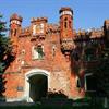
    Brest Castle

    Brest Castle was evolving in the course of several centuries from the Slavonic fortified settlement Berestye that had appeared at the turn of the 10th and 11th centuries at the confluence of the Mukhavets River into the Bug River, amid islands, formed by the rivers.

  • 1

    Castle Hill, Turov

    Castle Hill in Turov town in the Zhytkavichy District of Gomel Region of Belarus and the former capital of the medieval Principality of Turov and Pinsk.

  • 10

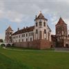
    Mir Castle Complex

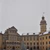
    The Mirsky Castle Complex is a UNESCO World Heritage site in Belarus. It is located in the town of Mir, in the Karelichy District of the Hrodna voblast, 29 km to the north-west from another World Heritage site, Nesvizh Castle.

  • 10

    Mozyr Castle

    The castle was built in Mozyr which is one of the oldest towns in the Belarusian Polesie in the 15th century. Walls and defensive towers surrounded a palace, residential and household buildings, St. Savior’s Church and the deepest well in Belarus which was erected in case of a longstanding siege of the castle.

  • 9

    Nesvizh Castle

    Nesvizh Castle or Niasvizh Castle is a residential castle of the Radziwill family in Nesvizh, Belarus. It is situated at an elevation of 183 meters. From 1921 to 1939 the complex was located in Poland and was considered one of the most beautiful Polish castles in the Kresy region.

  • 9

    Park Ensemble of Nesvizh Castle

    Park Ensemble of Nesvizh Castle or Niasvizh Castle is a residential castle of the Radziwill family in Nesvizh, Belarus.

  • 1

    Struve Geodetic Arc, Ivatsevichi

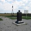
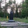
    The Struve Geodetic Arc is a chain of survey triangulations stretching from Hammerfest in Norway to the Black Sea, through ten countries and over 2,820 km, which yielded the first accurate measurement of a meridian.

  • 1

    Struve Geodetic Arc, Leskowitschi (Leskovichi)

    The Struve Geodetic Arc is a chain of survey triangulations stretching from Hammerfest in Norway to the Black Sea, through ten countries and over 2,820 km, which yielded the first accurate measurement of a meridian.

  • 1

    Struve Geodetic Arc, Lopati (Lopaty)

    The Struve Geodetic Arc is a chain of survey triangulations stretching from Hammerfest in Norway to the Black Sea, through ten countries and over 2,820 km, which yielded the first accurate measurement of a meridian.

  • 1

    Struve Geodetic Arc, Ossownitza (Ossovnitsa)

    The Struve Geodetic Arc is a chain of survey triangulations stretching from Hammerfest in Norway to the Black Sea, through ten countries and over 2,820 km, which yielded the first accurate measurement of a meridian.

  • 1

    Struve Geodetic Arc, Tchekutsk (Chekutsk)

    The Struve Geodetic Arc is a chain of survey triangulations stretching from Hammerfest in Norway to the Black Sea, through ten countries and over 2,820 km, which yielded the first accurate measurement of a meridian.

  • 1

    Struve Geodetic Arc, Tupischki (Tupishki)

    The Struve Geodetic Arc is a chain of survey triangulations stretching from Hammerfest in Norway to the Black Sea, through ten countries and over 2,820 km, which yielded the first accurate measurement of a meridian.